 Platform
Data minimisation by design
Coverage is proven from the street network and a GPS track, not from footage. Scope and GPS files are processed in your browser and are not uploaded, in line with the GDPR principle of collecting only what is needed.

Solutions
All Solutions Overview RailEyes RailEdge Camera RailEyes Survey PlannerRailEyes TrackViewNear-Real-Time Railway StreamRailEyes ZoningRailEyes Vegetation DetectionRailEyes Map/Track/Lane MatchingRailEyes AnonymizationRailEyes DynamicsRailEyes MapmatchingRailEyes HeatmapsConsultingApplications
Surface damage: potholes and cracksSign condition and visibilityPatrol coverage and street recencyAsset inventory against the mapCorridor surveysVegetation managementSolutions · Software & Data · Rail and road
RailEyes Survey Planner sets the exact streets, neighbourhoods or rail sections to survey before a drive. Afterwards, it checks from the GPS track alone that every planned street was covered, without sending a single frame of footage.
For data room users of the Smart Cities Programme: sign in with your data room account. See how it works.
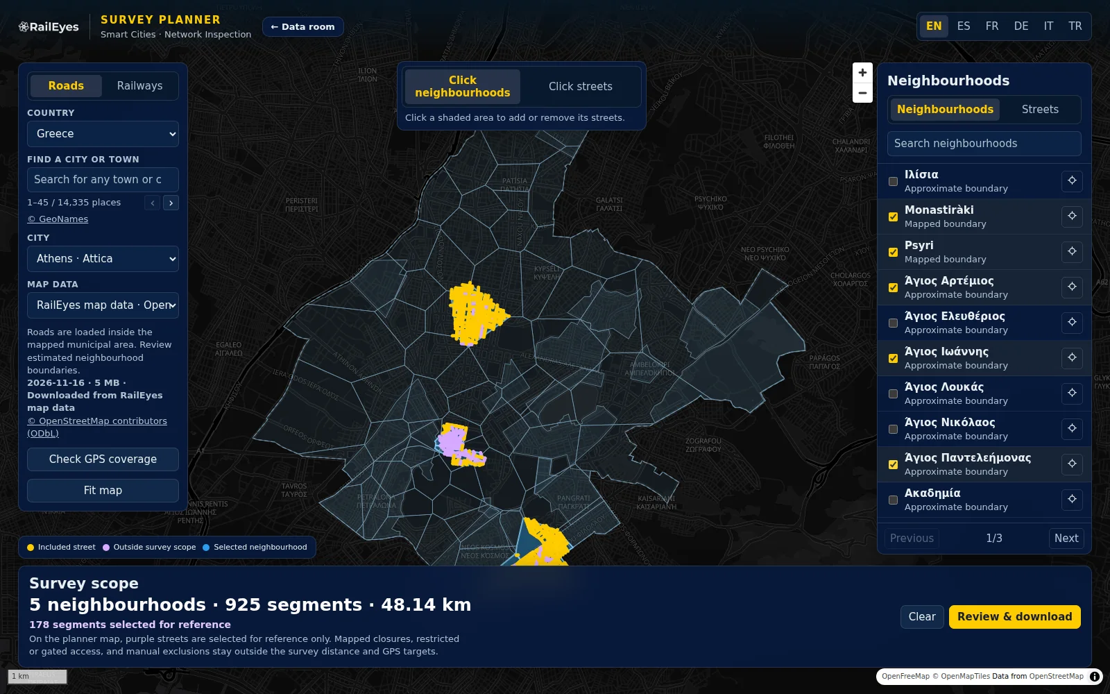
Before the survey
After the survey
How to use · Planning and validation
A worked example in Athis-Mons, France, covering Centre-Ville and Unmapped area 1: the city and the survey team agree the streets before the drive, and the city reviewer checks the drive against the vehicle’s GPS log afterwards.
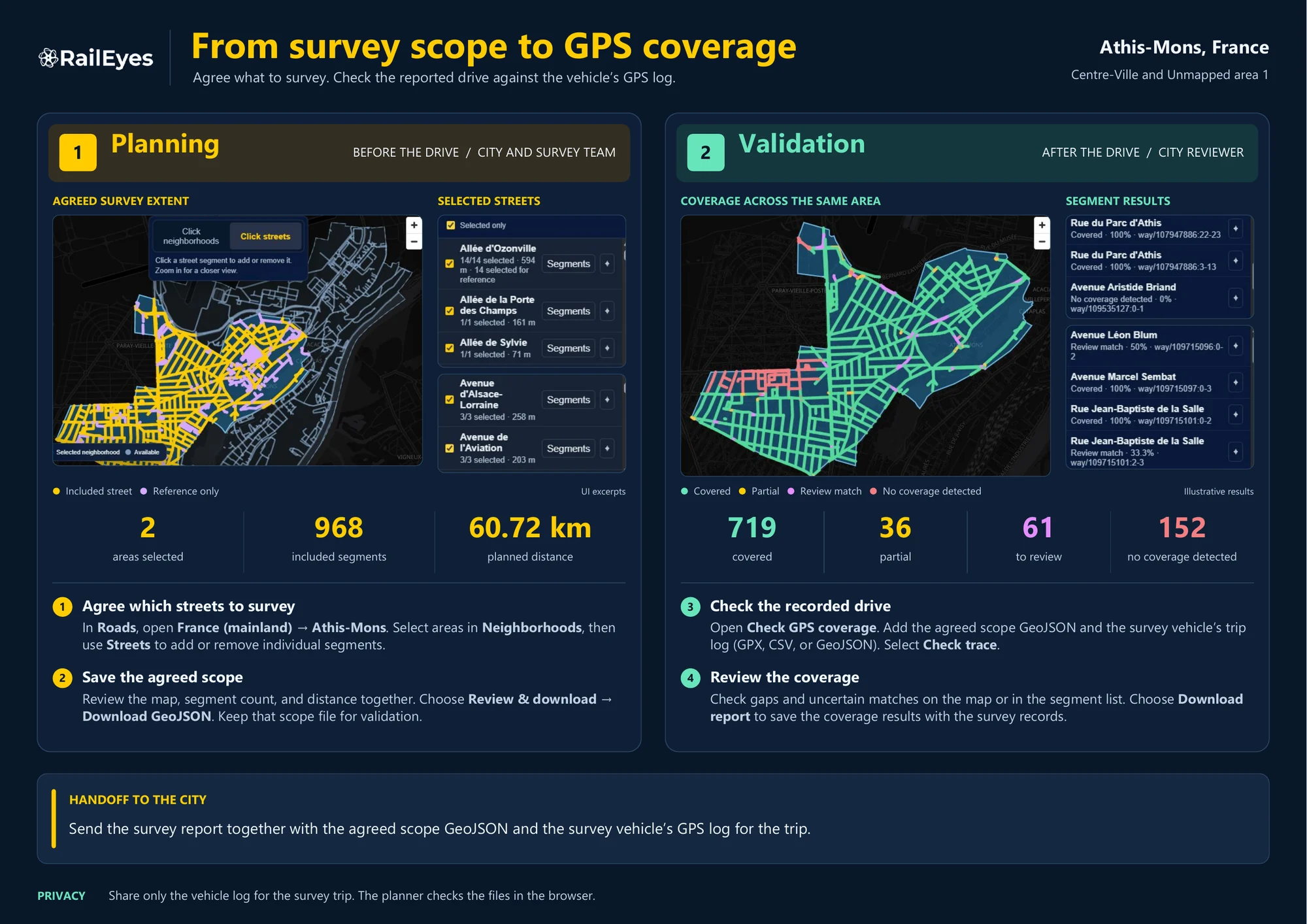
Handoff to the cityThe survey team sends the survey report together with the agreed scope GeoJSON and the survey vehicle’s GPS log for the trip.
PrivacyShare only the vehicle log for the survey trip. The planner checks the files in the browser.
Sample output · Survey scope
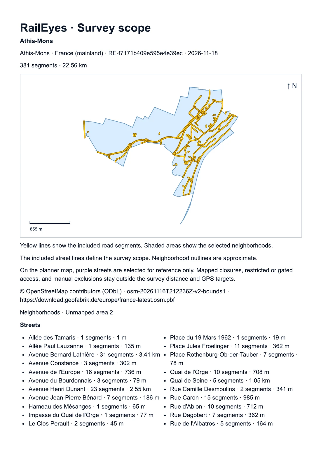
Next to the GeoJSON file, the planner prints the agreed scope as a document for the city, the road owner and the survey team: the same streets, the same distance, one reference.
Sample: Athis-Mons, France · 381 segments · 22.56 km · 2 pages
Coverage is proven from the street network and a GPS track, not from footage. Scope and GPS files are processed in your browser and are not uploaded, in line with the GDPR principle of collecting only what is needed.
Streets and neighbourhoods in the 18 programme countries, with municipal boundaries where they are mapped, and railway corridor sections by code and kilometre post.
GeoJSON scopes for your GIS, a printable scope document, and a segment-by-segment coverage report. GPS tracks from GPX, GeoJSON or CSV.
Questions
No. The planner works with the street network and a GPS track only. Scope and GPS files are processed in your browser and are not uploaded, so coverage can be checked without exchanging footage.
Roads, streets and neighbourhoods in Austria, Belgium, Denmark, Estonia, Finland, France (mainland), Germany, Greece, Italy, Latvia, Lithuania, Luxembourg, Netherlands, Poland, Portugal, Spain, Sweden, Türkiye, and railway corridor sections, starting with a pilot corridor in Spain.
It exports the survey scope as GeoJSON and a printable map. For the coverage check it reads GPS tracks as GPX, GeoJSON points or lines, or CSV with latitude and longitude.
Authorities with access to the Smart Cities Programme data room. Sign in with the same account to open the planner.
Map data © OpenStreetMap contributors (ODbL). Place names © GeoNames.