Operator value
Why railway teams care.
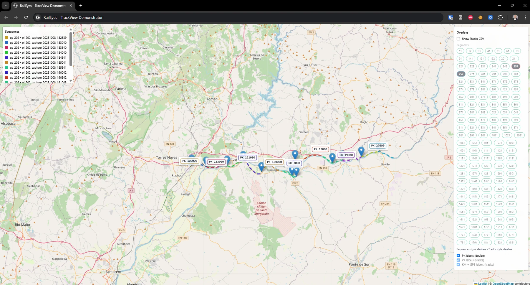
Inspection findings become easier to act on because each image, alert, or validation event is tied to railway infrastructure references operators already use.
Solutions
All Solutions Overview RailEyes RailEdge Camera RailEyes TrackViewReal-Time Railway StreamRailEyes ZoningRailEyes Vegetation DetectionRailEyes Map/Track/Lane MatchingRailEyes AnonymizationRailEyes DynamicsRailEyes MapmatchingRailEyes HeatmapsConsultingSoftware and Data Solution
Rail-specific location matching that connects GPS observations to tracks, segments, stations, and kilometer points instead of relying on road-oriented map matching.
Documented basis
Project reporting states that road map matching was unsuitable for the railway use case, leading to a custom rail network matching approach.
Operator value
Inspection findings become easier to act on because each image, alert, or validation event is tied to railway infrastructure references operators already use.
Investor value
Rail-specific geospatial intelligence is a core platform layer that can support multiple products beyond a single detection model.
Workflow
Outputs