Retrofit rail capture
RailEyes camera units combine visual capture, GPS/GNSS, cellular connectivity, local storage, thumbnails, and motion signals for deployment on existing rolling stock.
Solutions
All Solutions Overview RailEyes RailEdge Camera RailEyes TrackViewReal-Time Railway StreamRailEyes ZoningRailEyes Vegetation DetectionRailEyes Map/Track/Lane MatchingRailEyes AnonymizationRailEyes DynamicsRailEyes MapmatchingRailEyes HeatmapsConsultingTechnology
RailEyes separates responsibilities clearly: capture and first-pass data handling near the source, privacy and media processing in controlled workflows, and map-based analytics for inspection teams.
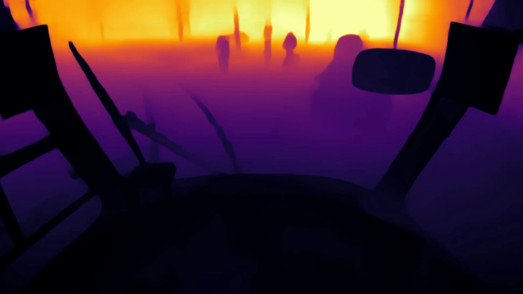
RailEyes camera units combine visual capture, GPS/GNSS, cellular connectivity, local storage, thumbnails, and motion signals for deployment on existing rolling stock.
The platform can upload metadata and thumbnails automatically while keeping full video selective, reducing bandwidth pressure and preserving segments of interest.
Automated anonymization workflows blur faces and prepare images or video for review in environments where staff, passengers, or the public may appear.
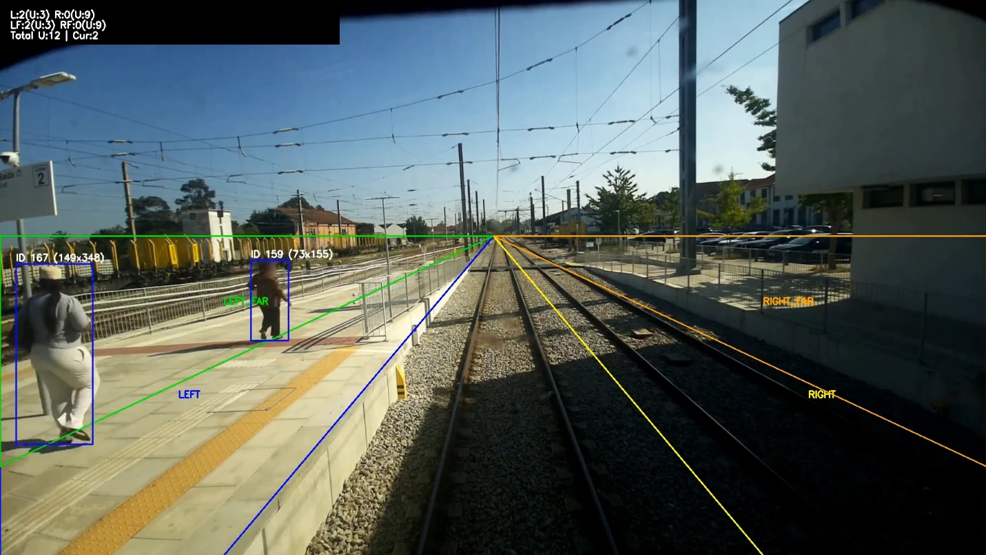
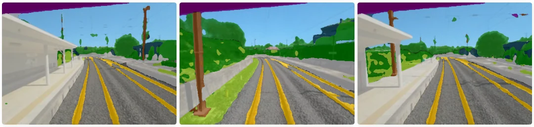
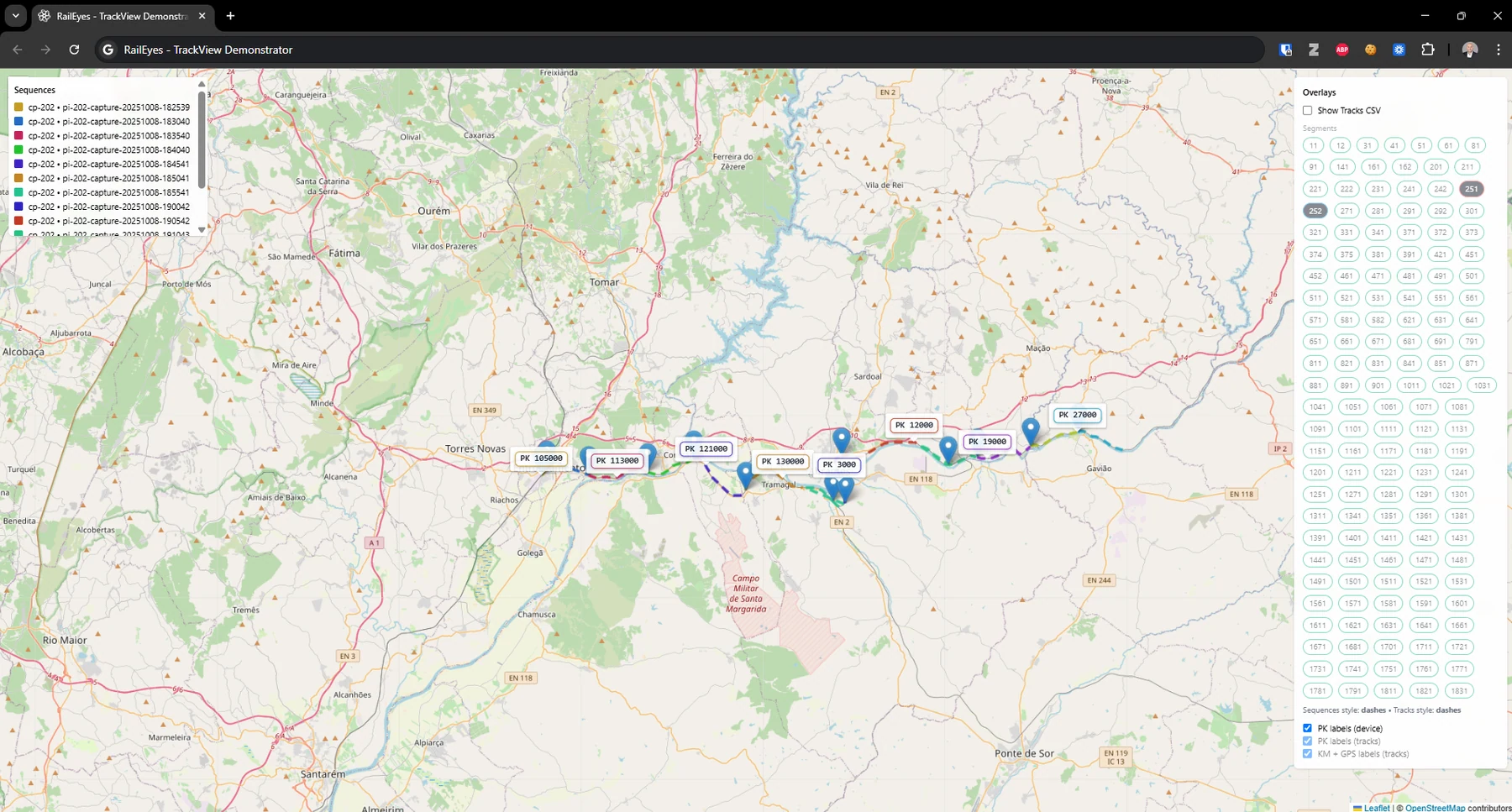
Observations are matched to rail network context such as track, station, segment, and kilometer references instead of relying on road-first location logic.
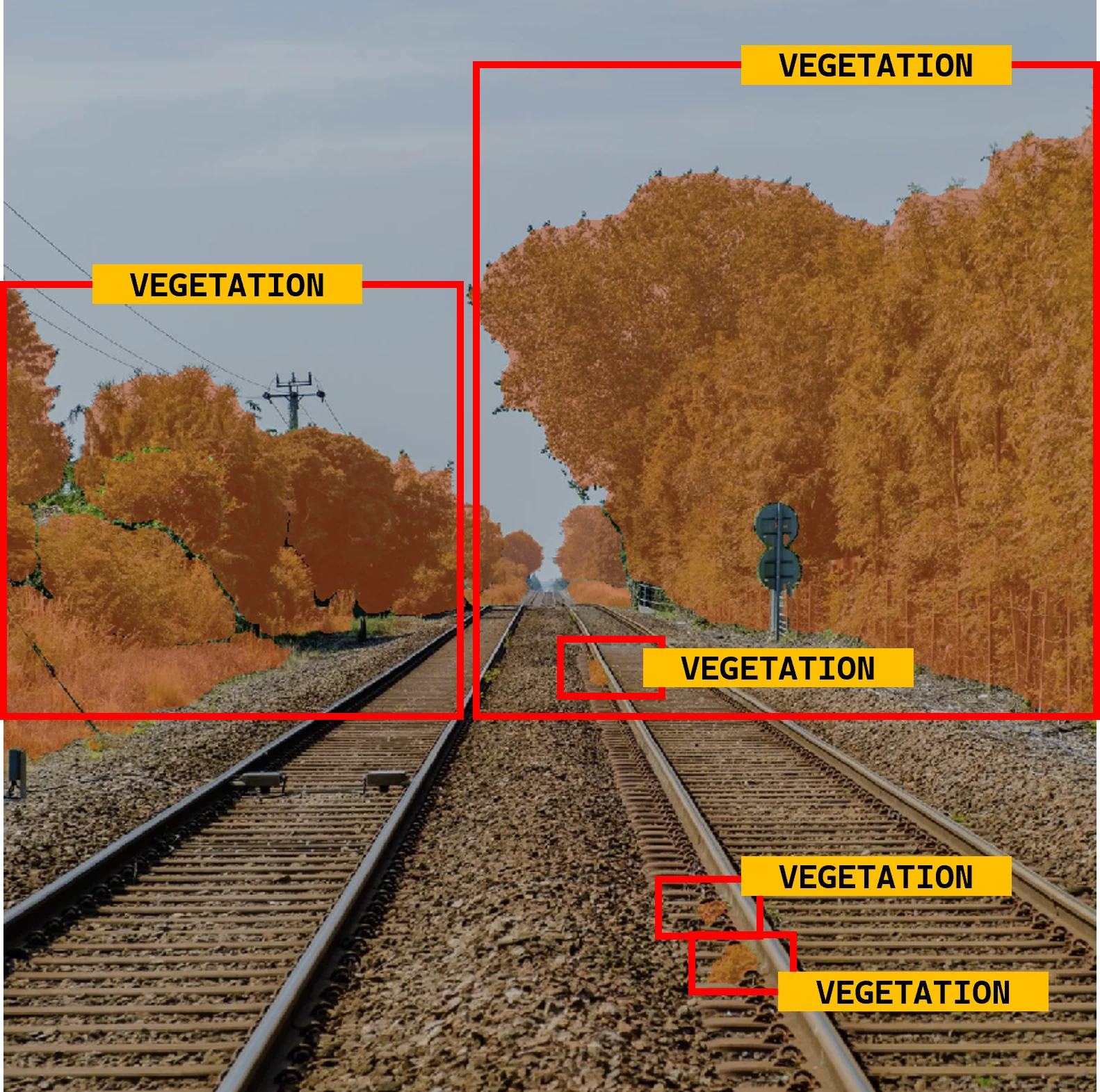
Vegetation segmentation, TrackView, zoning, pedestrian-density concepts, and asset review can reuse the same capture and location foundation.
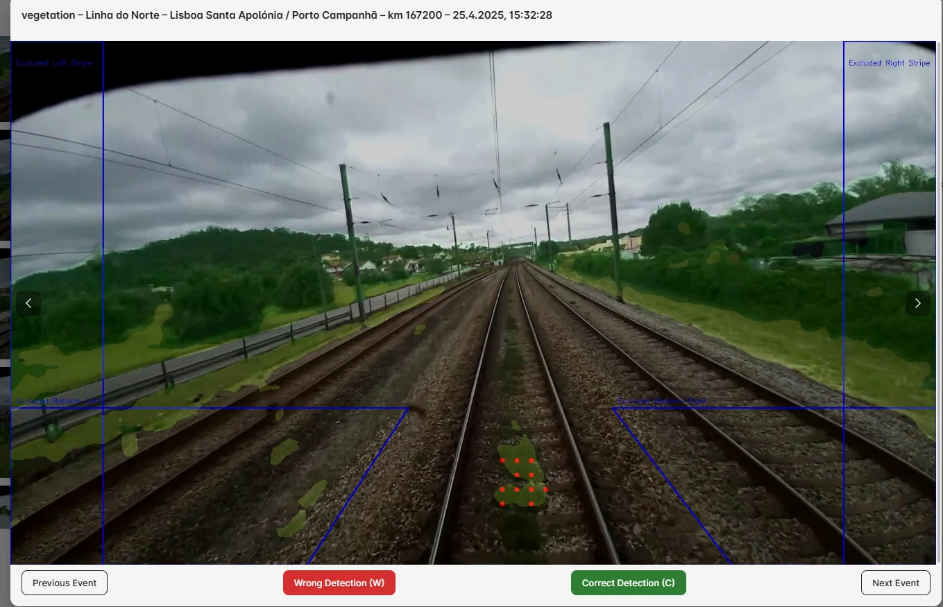
Operator review confirms or rejects AI findings, creating higher-quality datasets for model improvement and defensible inspection records.
Rail-trained perception
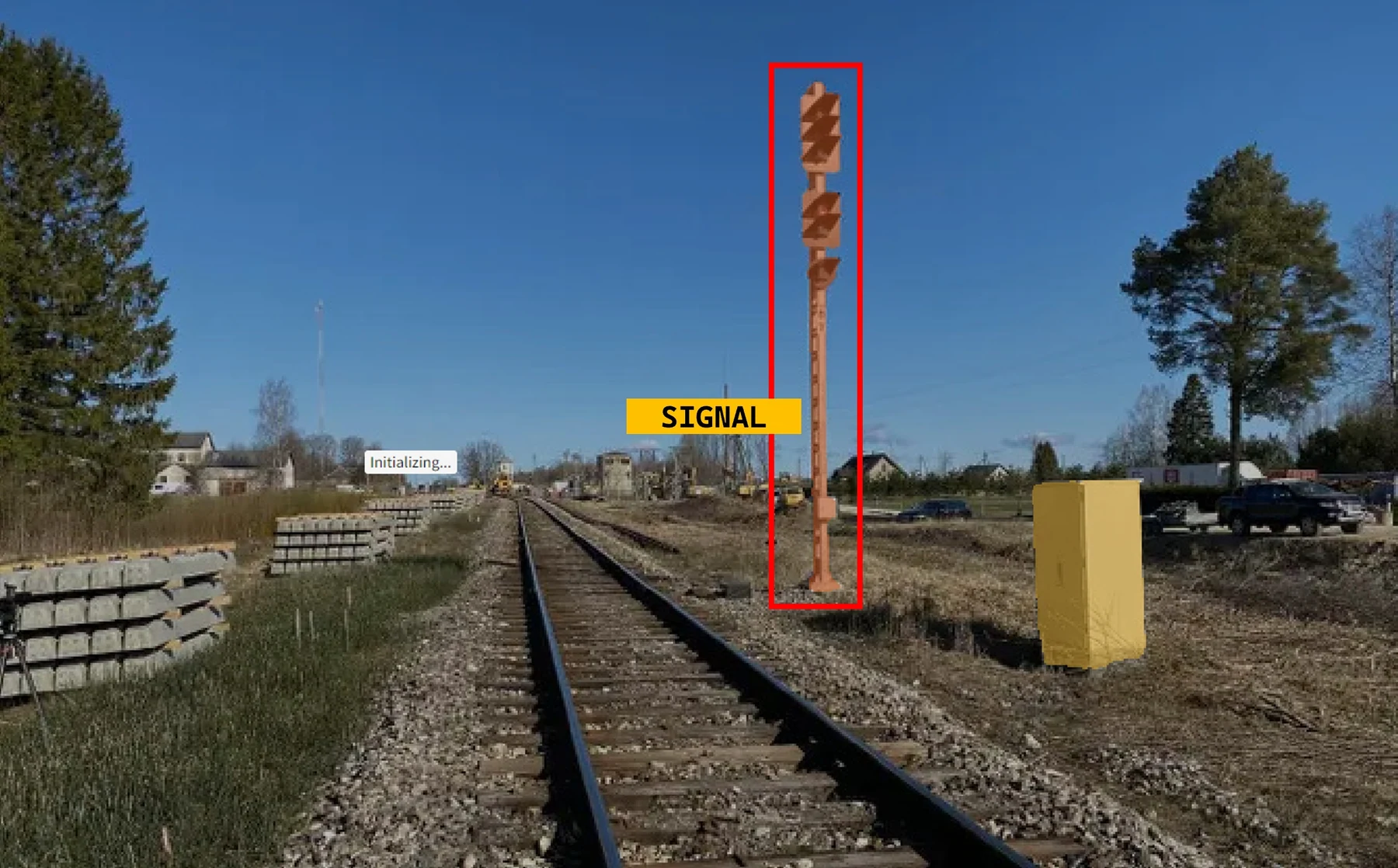
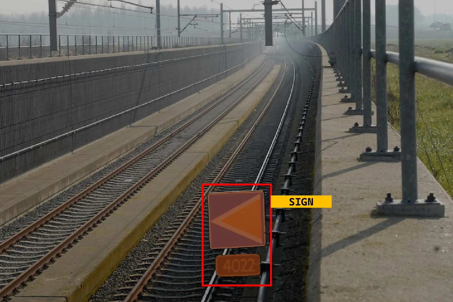
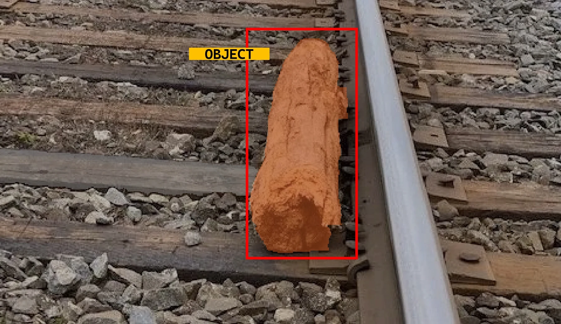
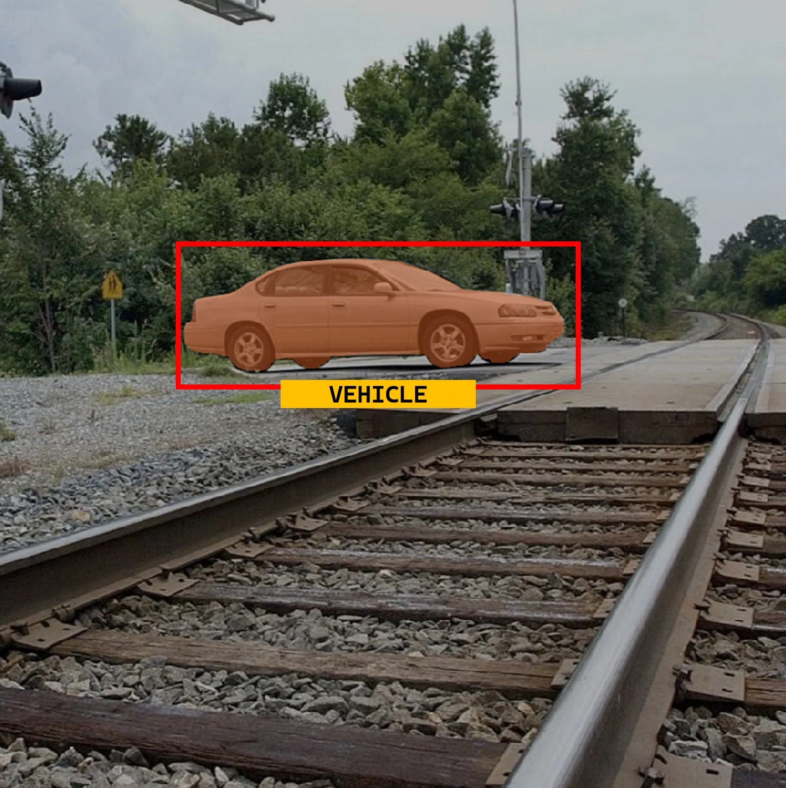
RailEyes is not built around generic object detection alone. Its proprietary inspection models are trained and refined using real railway corridor imagery, where vegetation, trackside assets, poles, tunnels, ballast, rails, and overhead structures create conditions that general-purpose models often misunderstand.
By combining semantic segmentation with depth-aware visual context, RailEyes helps operators understand what is present and how it relates spatially to the track environment, without requiring dedicated LiDAR hardware for every inspection workflow.
Not just vegetation detected, but vegetation detected in rail context, filtered by zones, distance, and review relevance.
Real railway imagery, corridor-specific false-positive correction, depth-aware processing, and human validation improve the model over time.
Architecture
The project reports describe real-world constraints that shaped the system: intermittent connectivity, large video files, GDPR notification requirements, hardware vibration, temperature exposure, and the need to connect every observation to rail infrastructure references.
Defensibility
Validated corridor imagery, vegetation labels, location references, and operator feedback can improve models in ways generic computer vision datasets cannot.
Anonymization and selective media handling help align the product with European public infrastructure expectations and procurement concerns.
Capture, storage, mapmatching, review, and validation can support multiple inspection modules instead of requiring a separate stack for each use case.
Existing rolling stock can become the data collection channel, which can make pilots more practical than specialized fleet-only inspection approaches.
Visual examples
These assets show the kind of camera evidence, detection overlays, and trackside context that RailEyes turns into reviewable infrastructure intelligence.