
 Platform
Applications
What RailEyes finds, from vehicles already in service.
One capture and review workflow, applied to the questions your teams ask: where the road is damaged, which signs need work, what was observed and when, and whether your inventory matches the street. Faces and number plates are anonymised at capture in every application.
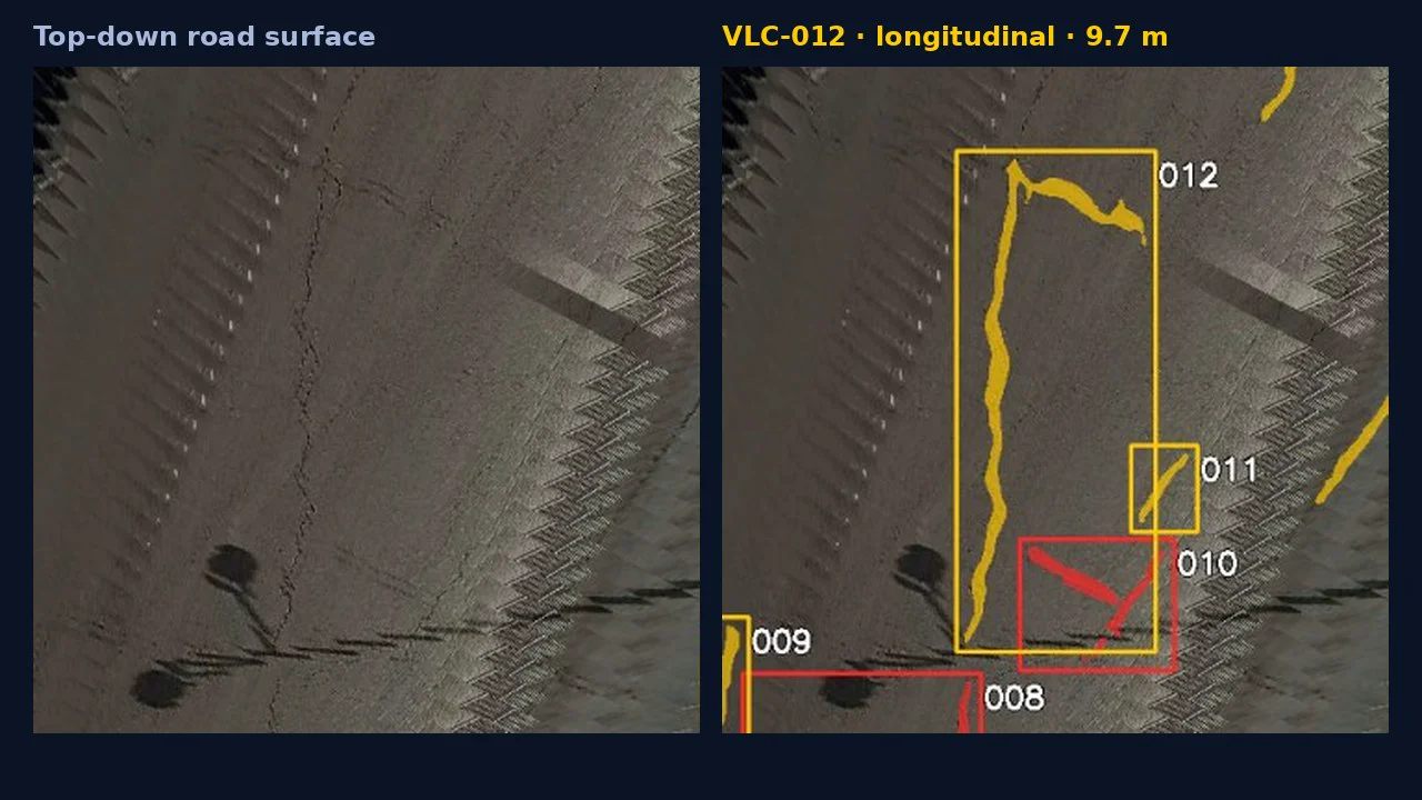
Surface damage: potholes and cracks
Potholes and cracks found in footage from vehicles already on the road. Each one becomes a case with an ID, a type, a length or area and a position, checked by a reviewer.
Smart CitiesRoads & Highways
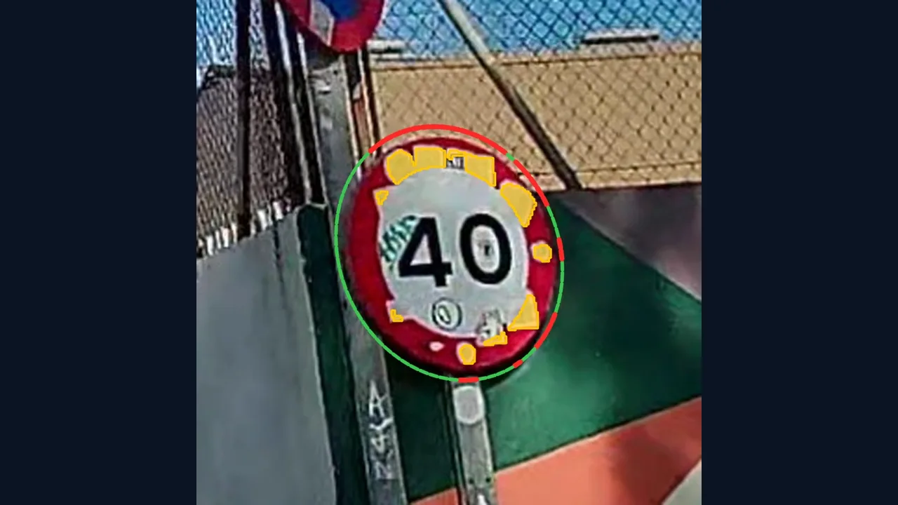
Sign condition and visibility
Signs covered by stickers, graffiti or damage, and signs hidden by vegetation or other obstructions, found on the approach and flagged with a maintenance action.
Smart CitiesRoads & HighwaysRail
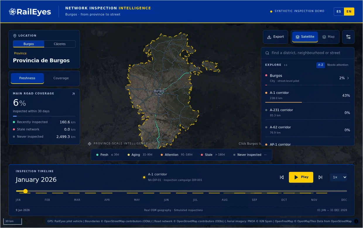
Patrol coverage and street recency
Every observation carries its time and route. You see which streets and kilometres were observed and when, and the ones that have gone too long without a pass stand out.
Roads & HighwaysSmart CitiesRail
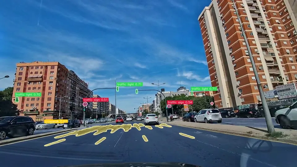
Asset inventory against the map
Signs, signals, crossings and street trees located from the footage and compared with your inventory or OpenStreetMap. Agreements are confirmed; mismatches are flagged for the inventory owner.
Smart CitiesRoads & Highways
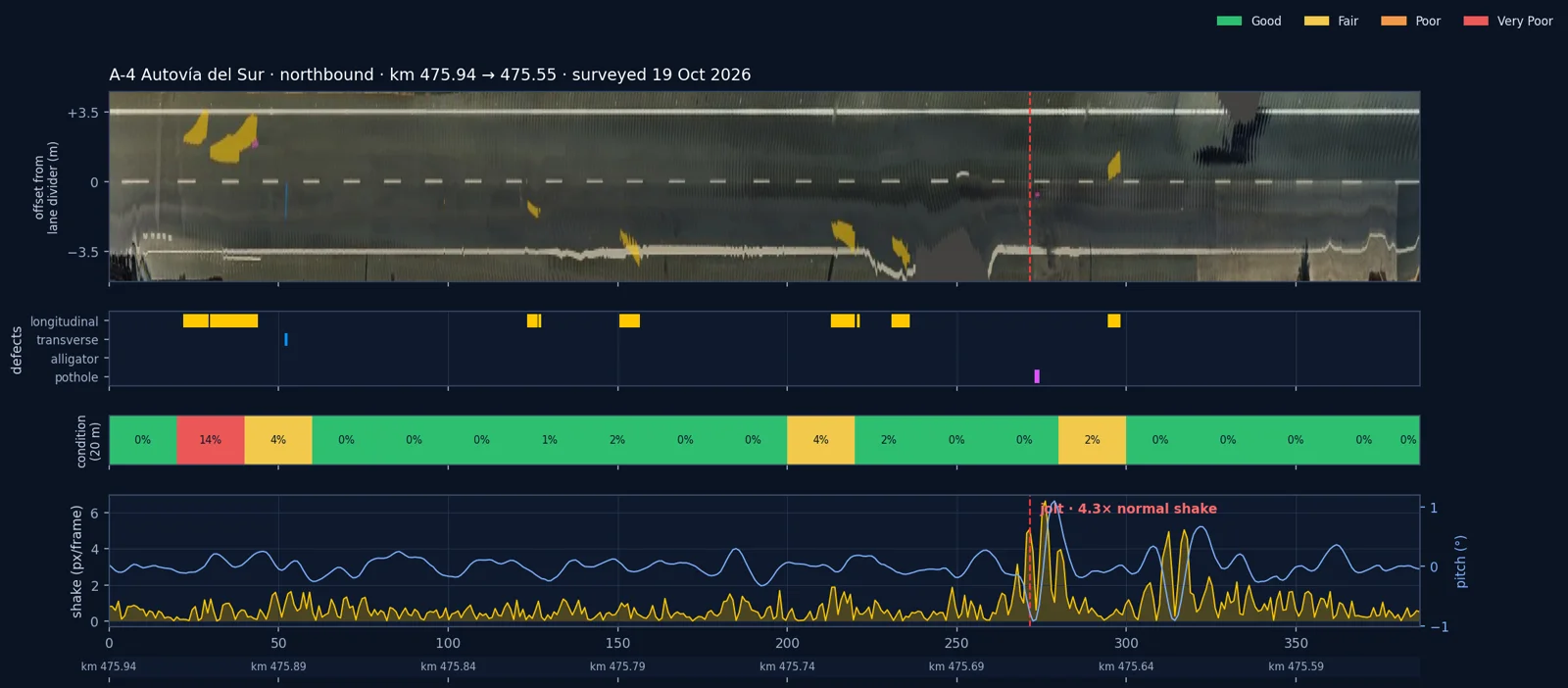
Corridor surveys
A corridor survey from a single patrol pass: top-down imagery of the carriageway aligned on its lane markings, every defect measured, sections graded and a straight-line diagram.
Roads & Highways
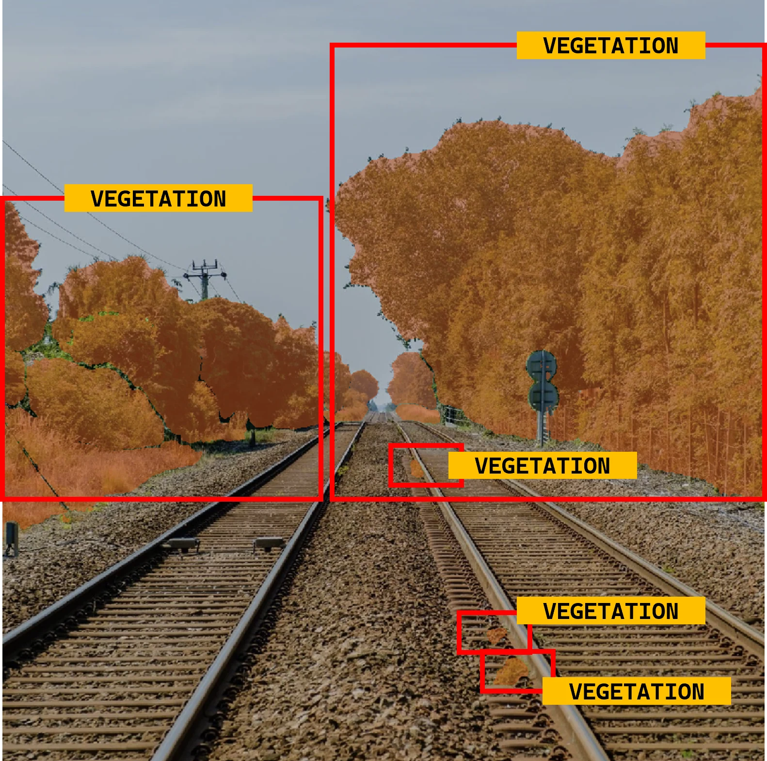
Vegetation management
Vegetation encroaching on the railway corridor, detected from cameras on trains already running their timetable. The CP and IP pilot ran the vegetation pipeline in scheduled service.
Rail